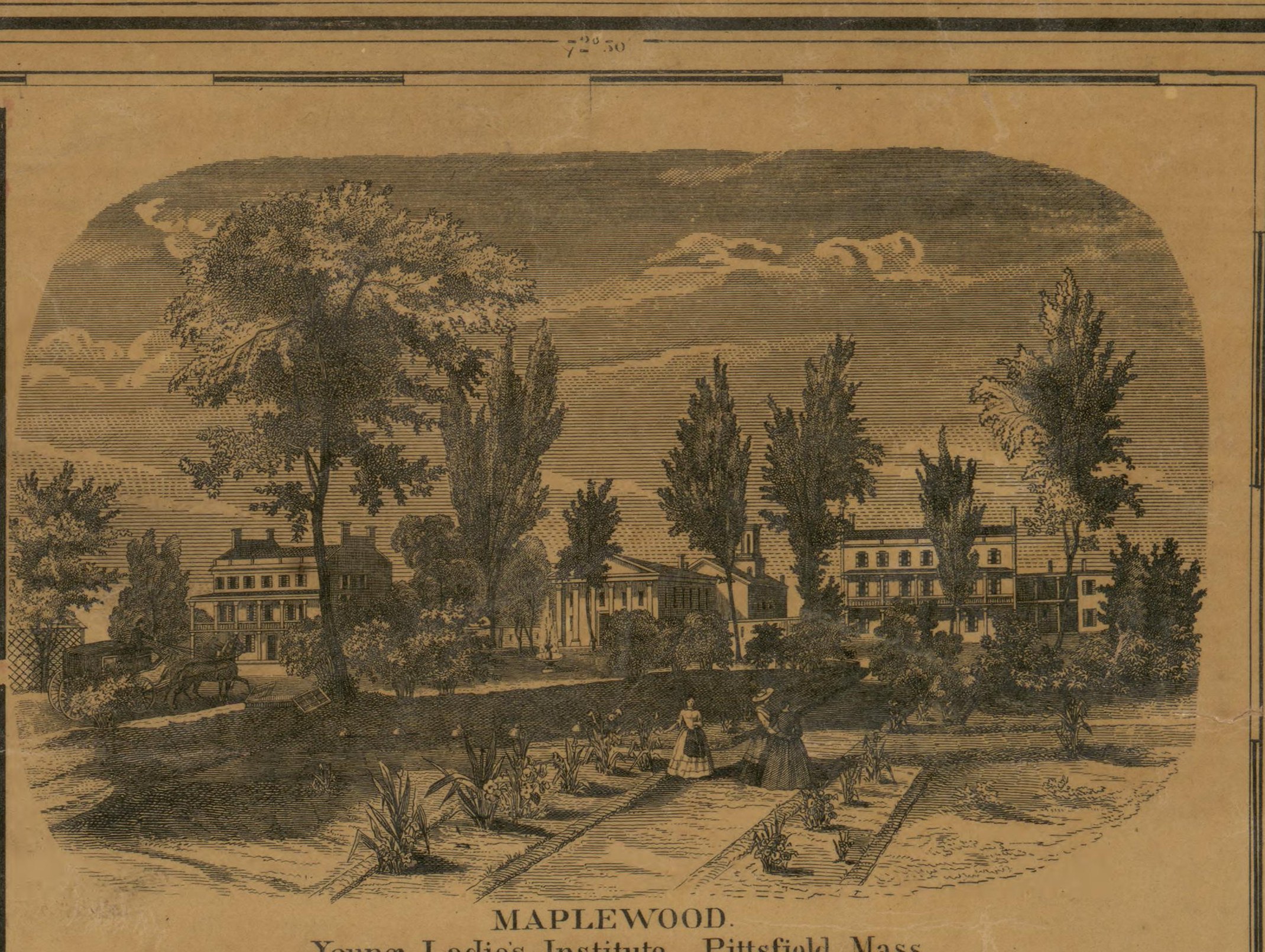
The building above is on the 1858 map itself, engraved in the top right corner of the sheet: Maplewood, Young Ladies’ Institute, Pittsfield, Mass. Two women are walking the garden paths and a carriage stands at the door. It is a school for girls.
By 1890 a photographer had it under a different name, and by 1904 the atlas prints MAPLEWOOD HOTEL on Maplewood Avenue. The same ground, three documents, one building that changed what it was for. That is the whole question in one lot: when did this county start taking visitors, and did the cottages bring them?
I. What the hypothesis predicts
If the visitor economy arrived with the cottages, the 1858 map should show a farming county with a tavern here and there, and the 1904 atlas should show a county that had built itself a lodging industry in between. The two maps are forty-six years apart and the cottages fall in the middle of them. It is a fair test.
It fails.
II. 1858: 6 hotels, before anything
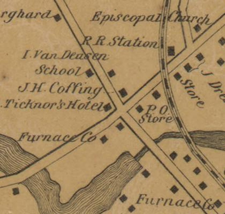
Forty-nine village plans ring Walling’s sheet, and every name on them has been read — 270 of them. Among those names are 6 hotels and 1 boarding house. The county had 52,791 people. 3 of its towns had a hotel in the village center.
Hotels by town, 1858
| Town | Hotels |
|---|---|
| Egremont | 2 |
| Lenox | 2 |
| Stockbridge | 2 |
Estates and named houses, 1904
| Town | Places |
|---|---|
| Lenox | 92 |
| Dalton | 48 |
| Pittsfield | 44 |
| Great Barrington | 36 |
| Lanesboro | 30 |
| Hancock | 27 |
| New Ashford | 27 |
| Williamstown | 25 |
| Stockbridge | 20 |
| Adams | 19 |
The second table is the one that moves. Hold it until section IV.
Eight plates label a building simply Hotel and leave it at that. The rest are named for whoever kept them — Hotel by P. Truesdell, J.P. Hunt Hotel, H Rogers Hotel, Hotel W. Merrills Heirs. A few carry the older house names that a traveler would have recognized anywhere in New England: the Berkshire House, in three different towns; the American House and the United States Hotel in Pittsfield; the Housatonic House in Lee; the Massachusetts House in Hancock; the Stockbridge House, whose proprietor W. Darbe is printed in the trade directory on the same sheet.
Two of them are worth stopping on. Lenox had R. Cone’s Hotel & Jail House — one building, both functions. And Great Barrington had an Invalid Hotel, which is to say that in 1858 people were already traveling into these hills for their health and there was a building up to receive them.
III. 1904: 53 hotels and inns, over the whole county
The Barnes & Farnham atlas of 1904 is a different kind of document. Fifty-eight plates, 14,848 names, the whole county at parcel level rather than forty-nine village centers. It casts a far wider net than Walling’s plans, and it catches 53 hotels and inns.
Set those side by side and the arithmetic is awkward for the usual story. Village centers alone in 1858: 7. The entire county in 1904: 53. The 1858 figure is a floor — the plans cannot show what stood between villages — and even so it very nearly matches a count taken over far more ground at the height of the Gilded Age.
The lodging stock did not arrive with the cottages. It was already there.
IV. What did change
Something in these two maps did multiply, and it was not hotels. The 1904 atlas marks 379 estates and named houses — country places carrying a name of their own instead of an owner’s initials. Lenox alone has 92.
So the shape of the change is the reverse of the hypothesis. The inns were there first; what the Gilded Age built was private houses. The cottage people did not bring the visitor economy with them. They arrived inside it — as somebody’s guests, at the Curtis or the Maplewood or in a boarding house — and then bought land.
V. One hotel that proves it by name
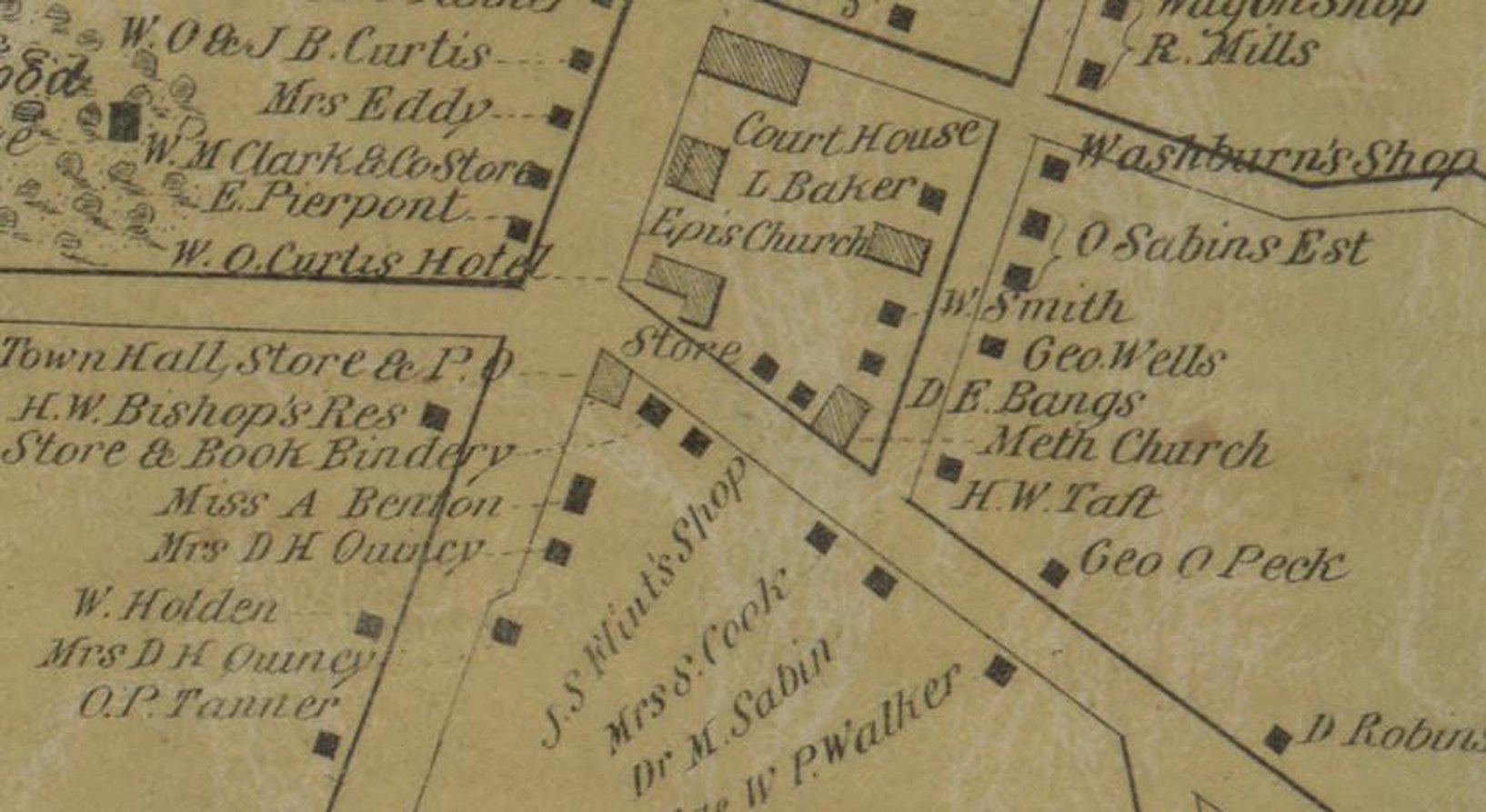
The 1858 Lenox plate labels a building on Main Street W. O. Curtis Hotel. The 1904 atlas labels the same site CURTIS HOTEL on three separate plates. It is still there.
The Curtis was taking guests in Lenox before Lenox had a cottage, and it was still taking them when the cottages were at their peak. Whatever brought the first visitors to this town, it was not a cottage, because there weren’t any.
VI. A girls’ school becomes a resort
The Maplewood is the other half of the argument and the clearer picture of it. In 1858 the village plan of Pittsfield labels it school, and the sheet carries the engraving at the head of this page. In 1890 Blatchford photographed it as a hotel. In 1904 the atlas prints its name as one.
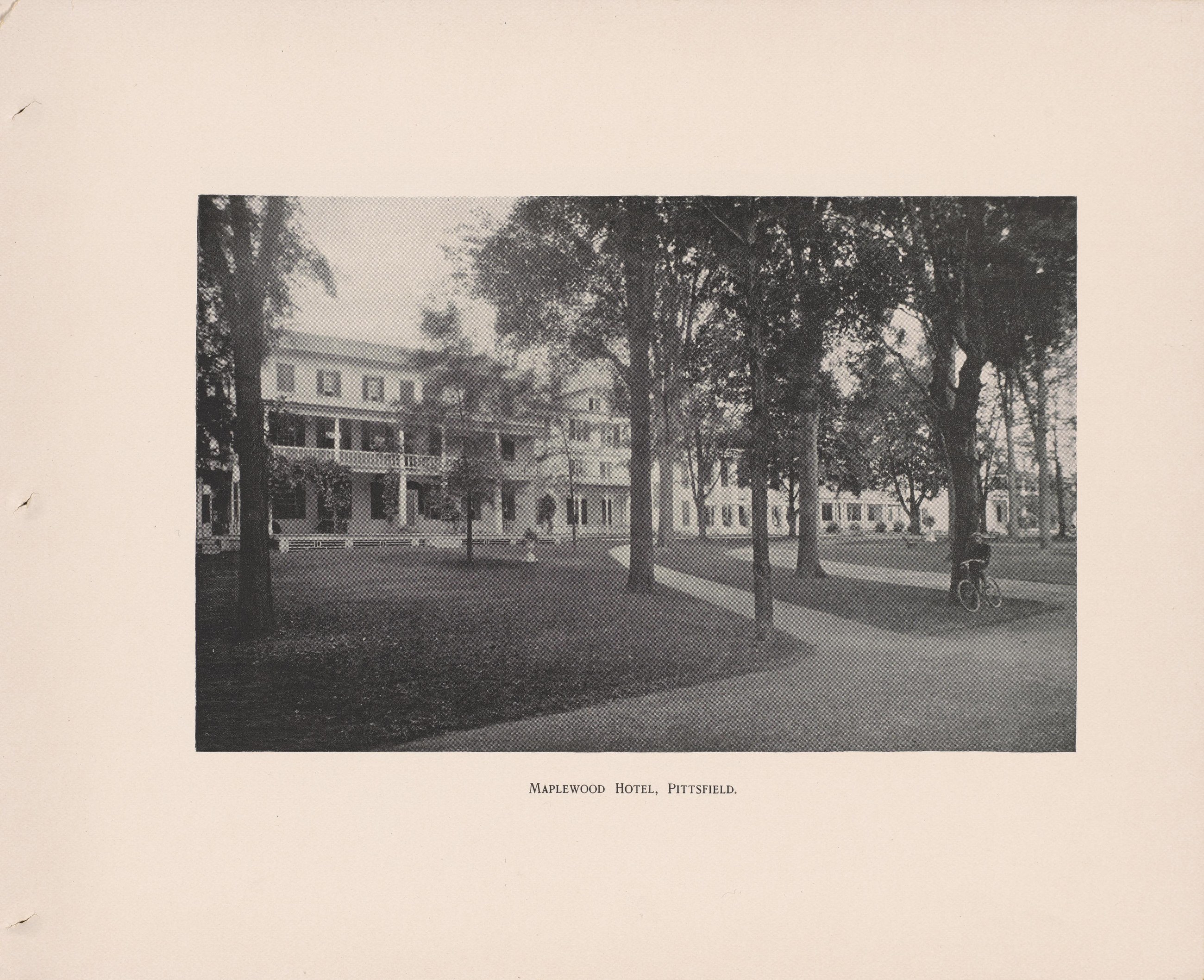
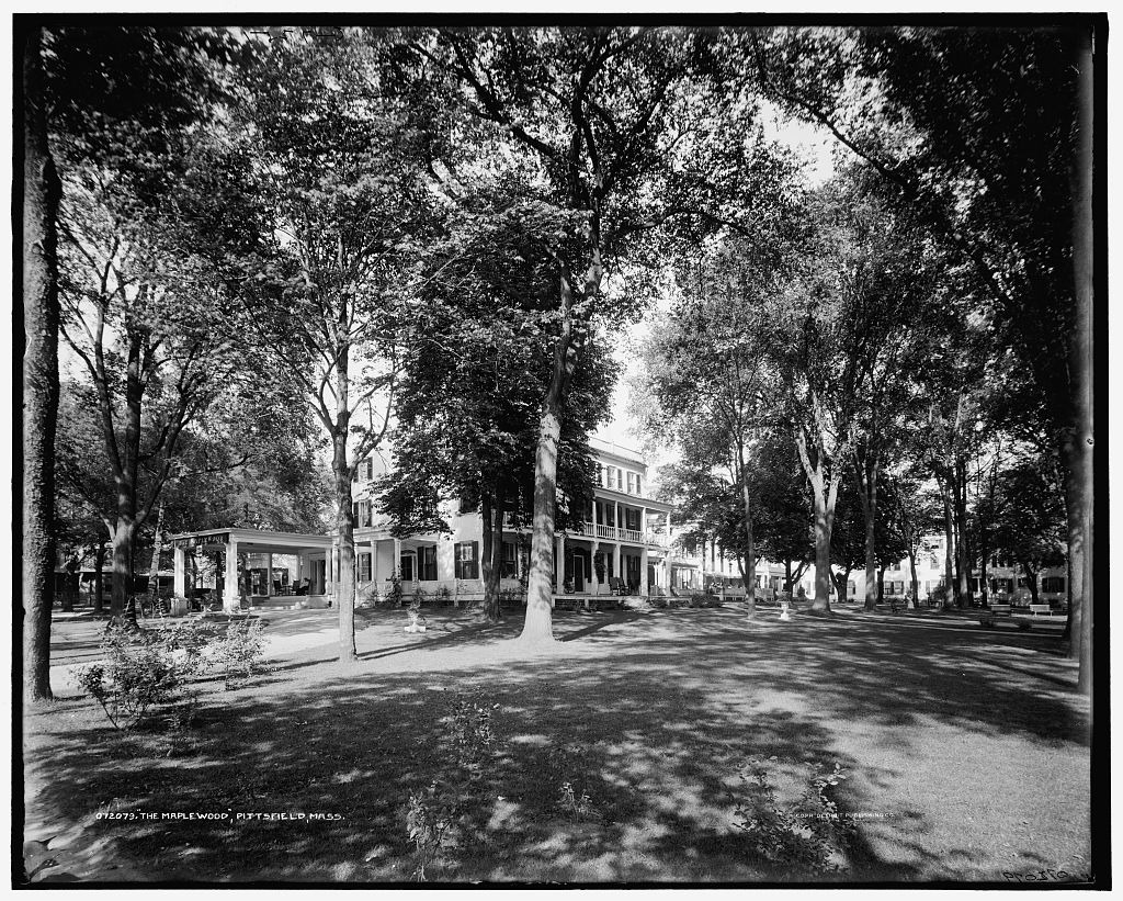
A school for young ladies did not become a resort hotel because cottages were built nearby. It became one because people were already coming, and a large building with grounds on the edge of Pittsfield was worth more full of guests than full of pupils.
VII. The country was not empty either
The village plans are only the villages. The county map on the same sheet draws the open country road by road, and it is there that the case gets interesting — because Walling engraved the names of country places in 1858 that nobody would call cottages and everybody would recognize.
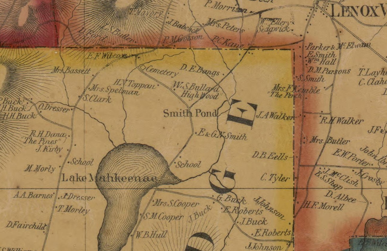
On the slopes above the Stockbridge Bowl the map names “The Perch” for Mrs. F. Kemble — Fanny Kemble, the actress — and “Highwood” for W. S. Bullard, and “The Pines” for R. H. Dana. Over the Pittsfield line it names Arrowhead, with H. Melville beside it, and “Broad Hall” by the Morewood place.
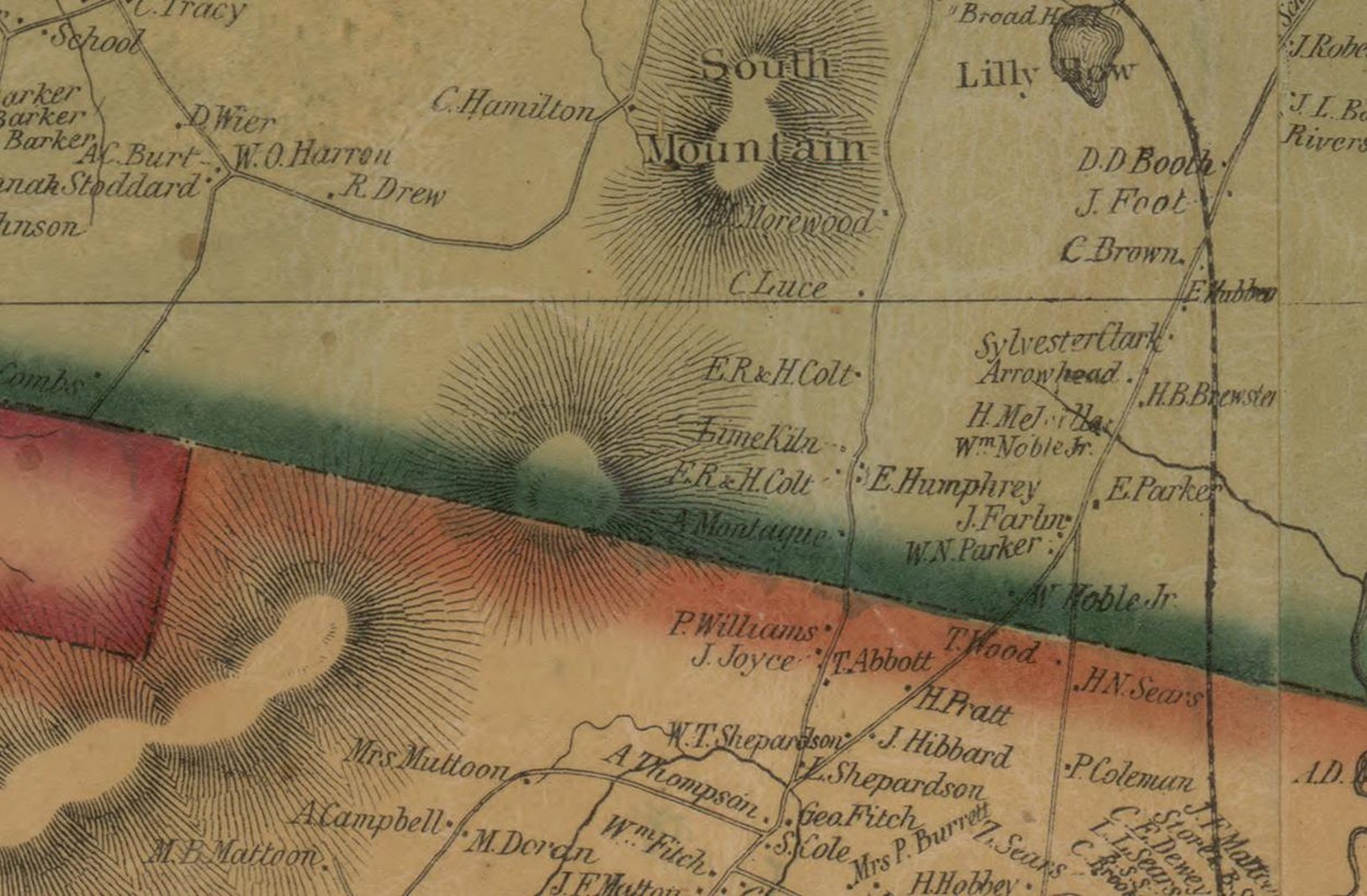
Five named country places in a few square miles, thirty years early, belonging to a celebrated actress and two literary families. Walling thought the names worth the engraver’s time, which means a reader of this map in 1858 was expected to know them. That is not a county waiting to be discovered.
Two houses on one sheet
The two names above are not merely famous separately. Arrowhead and Highwood are six miles apart on this map, and the friendship between the men attached to them is the best-known in American letters.
Melville is at Arrowhead on the plate, engraved by name, and he was still there when the map was published. Hawthorne had been the Tappans’ tenant in the little red farmhouse on the Highwood land, where he wrote through 1850 and 1851, and the map labels that ground H. Y. Toppan and W. S. Bullard — High Wood. The two of them walked between the two houses.
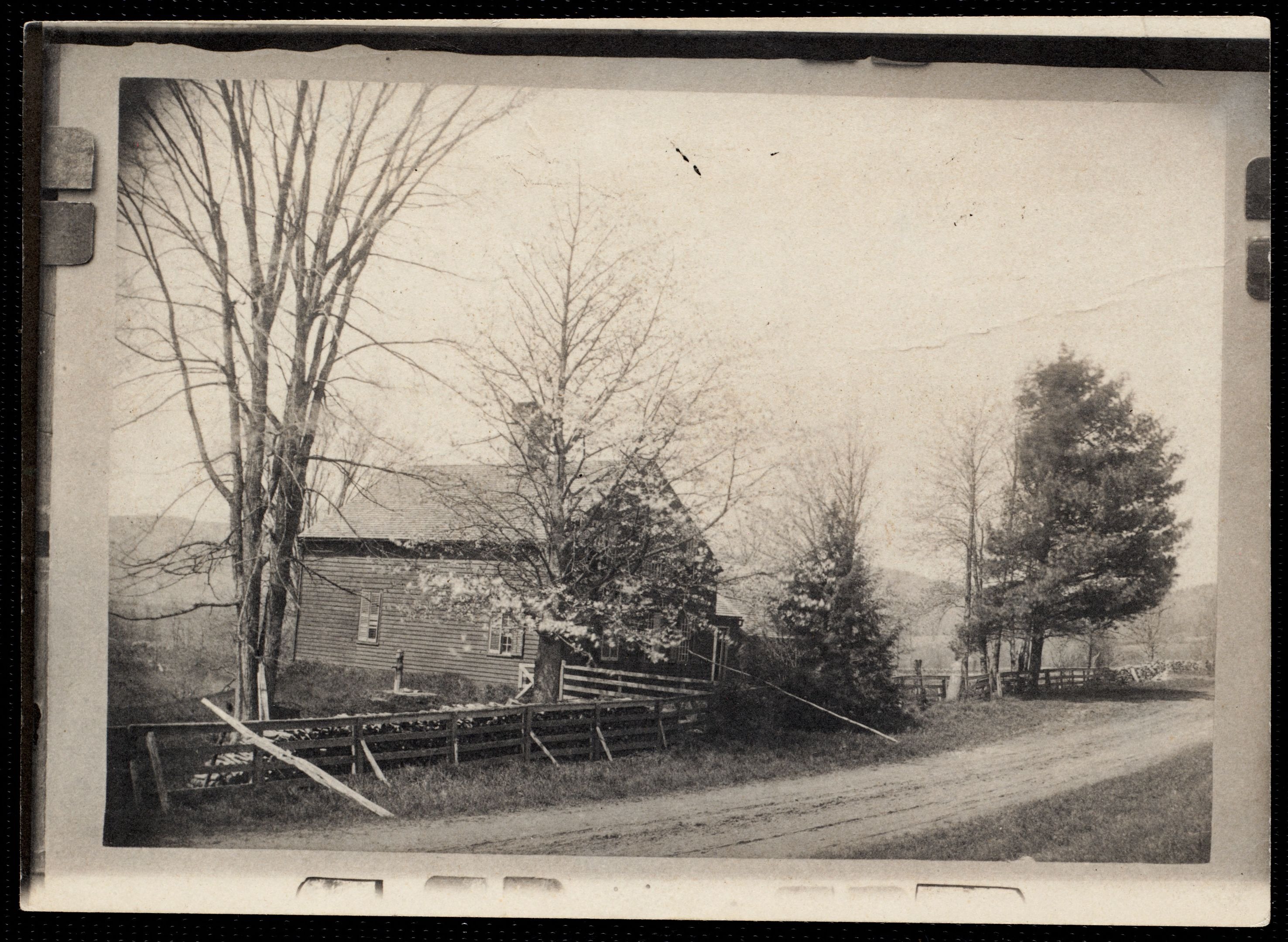
This is the mechanism the hotel count cannot show. A celebrated writer takes a farmhouse for a summer; another is five miles off; the people who come to see them need somewhere to sleep, and the Curtis and the Maplewood and a dozen farm kitchens take them in. Literary elites attract literary elites, and the ones who could afford to stay bought the hill they had been looking at. The cottages are the third act of that, not the first.
VIII. What neither map can see
A count of hotels is not a count of visitors, and this is where both documents go quiet.
A farmhouse that took boarders is invisible. Walling labelled the occupier of a house, not what the occupier did with it, so a farm family letting rooms through July is engraved exactly like a farm family that is not. There is a local tradition that the Smiths whose farm became Wheatleigh kept an inn on that ground. The map puts E. & G. W. Smith there, beside a pond it calls Smith Pond — the water now known as Lily Pond — and gives them no hotel label. But it would not, and nothing on the sheet contradicts the tradition.
And a count of roofs is not a count of beds. The 1858 houses are village taverns named for the man who kept them. By 1904 the same list holds the Aspinwall. The number of buildings barely moved; what went on inside them changed out of recognition, and nothing in either map measures it.
Both of those cut the same way: they mean the visitor economy of 1858 was larger than 7 buildings, not smaller.
IX. What the data supports
The visitor economy did not begin with the cottages. It was running in 1858 — 6 hotels, 1 boarding house, a hotel built for invalids, a hotel on Main Street in Lenox that is open today, and a ring of named literary houses around the Stockbridge Bowl.
What the cottage era did was not create the trade. It changed who owned the view. In 1858 a visitor to Lenox stayed at the Curtis and walked out to look at the lake. By 1904 92 named places in that one town held the ground the view was taken from, and the hotels — still about the same number of them — served a county where the best land was no longer open.
None of which is new, only local. That power goes where beauty is was already an old observation two and a half thousand years ago, and this county is a late and small instance of it. What the two maps add is the order and the dates: the writers noticed first and said so in public, the inns that were already standing filled up, and then the ground changed hands.
X. The same order of events elsewhere
Nothing in these two maps says anything about anywhere but Berkshire County, and what follows is offered as a question rather than a finding.
The sequence here runs: a few writers and a famous actress take houses in a farming county; people come to look; the inns and the farm kitchens take them in; and then the money arrives and buys the ground. It is a sequence worth holding up against other American places that are now known for being beautiful and expensive. Provincetown’s art colony is conventionally dated to 1899, when Charles W. Hawthorne opened the Cape Cod School of Art there — a fishing town first, painters second, and the rest after that.
If it holds elsewhere it is an order of events, not a verdict on any of it: the artists arrive first and the capital follows them in. This map cannot settle whether that is general. It can only show that in one county the artists were there first, and that the people who built the great houses were, at the start, somebody’s guests.
XI. The counts, in full
Both tables are built from the transcriptions behind this site, not typed in. Every 1858 entry links to the plan it was read off.
Lodging on the 1858 village plans
| Town | As engraved | Kind |
|---|---|---|
| Egremont | Mt Everett House | hotel |
| Egremont | Wm A. Forbes | hotel |
| Lenox | J C Arnold's Boarding House | boarding house |
| Lenox | R. Cone's Hotel & Jail House | hotel |
| Lenox | W. O. Curtis Hotel | hotel |
| Stockbridge | Stockbridge House | hotel |
| Stockbridge | W. Darbe | hotel |
Map of the County of Berkshire, Massachusetts, Henry Francis Walling, 1858. Library of Congress, Geography and Map Division, g3763b la000307. Public domain. Read off the forty-nine village plans; the county map proper is not yet transcribed, so this is a floor and not a county total.
Hotels and inns in the 1904 atlas
| Plate towns | As printed | Where |
|---|---|---|
| Pittsfield | DEWEY HOTEL | Coltsville |
| Pittsfield | BURBANK HOUSE | at Union Depot |
| Pittsfield | MAPLEWOOD HOTEL | Maplewood Ave. |
| Pittsfield | NORWOOD HOTEL | North St. |
| Pittsfield | PARKER HOUSE | West St. |
| Pittsfield | BEECH GROVE INN | Beech Grove Av. |
| Pittsfield | WOODLAWN INN | east of Woodlawn Ave, north of Dalton St |
| Dalton | IRVING HOUSE | Dalton Village (West) plan; N side of Main St |
| Dalton | EAGLE HOTEL | Dalton plan; corner of Main St |
| Lanesboro, Hancock, New Ashford | LANESBORO INN | hotel on South Main St, Lanesboro village map |
| Lenox | Aspinwall Hotel | |
| Lenox | Curtis Hotel | |
| Lenox | Curtis Hotel | Main Street |
| Lenox | LAUREL LAKE HOTEL | |
| Lenox | CURTIS HOTEL | Main Street |
| Lenox, Lee | Eldorado Hotel | Lenoxdale |
| Cheshire, Adams, North Adams, Williamstown | CHESHIRE INN | |
| Cheshire, Adams, North Adams, Williamstown | SUMMIT HOUSE | on Greylock Mt. |
| West Stockbridge, Richmond | HOTEL | West Stockbridge village |
| Stockbridge | RED LION INN | on Main St |
| Lee | Hotel | town map, at Laurel Lake |
| Lee | HOTEL | East Lee |
| Lee | GREENOCK INN | |
| Lee | HOTEL | at Quigley's Corner |
| Lee | Lee Hotel Co. | |
| Lee | MORGAN HOUSE | on Main St |
| Becket | CLAFLIN HOUSE | North Becket |
| Becket | Hotel Stables | North Becket |
| Mount Washington, Tyringham | RIVERSIDE INN | Tyringham village |
| Great Barrington | HOTEL WAVERLY | Main St. business block, village plan |
| Great Barrington | MILLER HOUSE | Main St. business block, village plan |
| Great Barrington | RIVERSIDE INN | north of the Housatonic near the Marble Yard, village plan |
| Great Barrington | "BARRINGTON HOUSE" | east of Main St., in quotation marks, village plan |
| Great Barrington | BERKSHIRE INN | Main St., north part of the village plan, village plan |
| Great Barrington | COLLINS HOUSE | Main St., lettered vertically over the hotel lot, village plan |
| Great Barrington | HOUSATONIC HOTEL | Main St., Housatonic plan |
| Egremont, Alford | CLIFF HOUSE | Egremont town map, at Prospect Lake |
| Egremont, Alford | MT. EVERETT HOUSE | South Egremont inset; hotel |
| Sheffield | MAPLEWOOD INN | Ashley Falls inset, hotel |
| New Marlboro | "INN" BARN | New Marlborough inset |
| New Marlboro | Mrs. P. Callendar HOTEL | Mill River inset |
| New Marlboro | NEW MARLBOROUGH INN | New Marlborough inset; INN BARN also labeled |
| Savoy, Windsor | MOUNTAIN HOUSE | Savoy town map, Savoy P. O.; hotel, owner printed beneath |
| Williamstown | IDLEWILD HOTEL | South Williamstown; hotel |
| Williamstown | DUNCAN HOUSE | building on Main St. |
| Williamstown | THE GREYLOCK HOTEL | hotel at Main and North Sts. |
| Williamstown | COTTAGE INN | inn near the station |
| Clarksburg, Florida | RICES INN | Hoosac Tunnel plan |
| Clarksburg, Florida | STAMFORD HOUSE | Clarksburg plan; hotel on the Stamford road |
| North Adams | RICHMOND HOUSE | Main St. |
| Adams | ADAMS HOUSE | hotel |
| Adams | BERKSHIRE HOUSE | hotel |
| Adams | GREYLOCK HOUSE | hotel |
Atlas of Berkshire County, Massachusetts, Barnes & Farnham, 1904. Boston Public Library, commonwealth:vx0245605. No known copyright restrictions. Labels containing Hotel or Inn, plus the House names that were hotels; engine, freight, round, parish, town, club and fraternity houses are excluded by hand, which is a judgment and is open to re-reading.
Central Berkshire Illustrated, J. H. Blatchford, 1890. Maplewood photograph on leaf 15. Provincetown Art Association and Museum, on Charles W. Hawthorne: “In 1899 he opened the Cape Cod School of Art in Provincetown, marking the beginning of Provincetown as an art colony.” The 1858 and 1904 counts are not like for like and are not presented as if they were: the first is forty-nine village centers, the second is the whole county at parcel level. That asymmetry runs against the conclusion drawn here, not for it.