Barnes & Farnham printed two indexes on one page in 1904 — Town Plans and City or Village Plans — and between them they name every place in the county the atlas draws. What follows is those two lists transcribed, in the book’s spellings, with the plate numbers turned into links. The third list is the fifty-eight plates themselves, titled as the plates title themselves rather than as the contents page does.
The 1904 atlas
The plates
The book’s own table of contents, made to work: fifty-eight plates, thirty-two town plans and about ninety village plans, every one of them a link into the sheet.
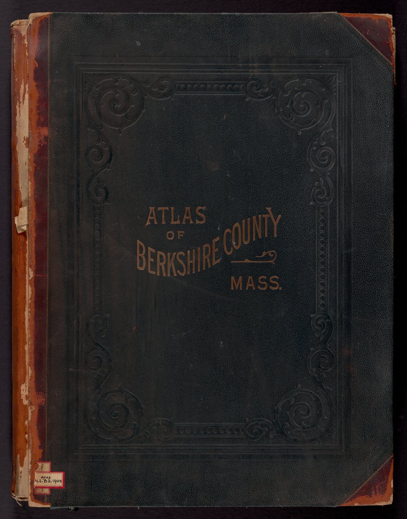
Every plate link below opens the sheet here. Arrow keys turn the page. Select Expand, or click the page, to open the plate full screen and go in to full resolution.
Towns
Thirty-two town plans. The town plates are drawn at 1,500 feet to the inch.
| Town | Plate |
|---|---|
| Adams | Plate 54 |
| Alford | Plate 37 |
| Becket | Plate 31 |
| Cheshire | Plate 43 |
| Clarksburg | Plate 48 |
| Dalton | Plate 12 |
| Egremont | Plate 37 |
| Florida | Plate 48 |
| Great Barrington | Plate 33 |
| Hancock | Plate 16 |
| Hinsdale | Plate 14 |
| Lanesboro | Plate 43 |
| Lee | Plate 29 |
| Lenox | Plate 18 |
| Monterey | Plate 41 |
| Mount Washington | Plate 32 |
| New Ashford | Plate 16 |
| New Marlboro | Plate 39 |
| North Adams | Plate 49 |
| Otis | Plate 41 |
| Peru | Plate 14 |
| Pittsfield | Plate 1 |
| Richmond | Plate 26 |
| Sandisfield | Plate 40 |
| Savoy | Plate 42 |
| Sheffield | Plate 38 |
| Stockbridge | Plate 27 |
| Tyringham | Plate 32 |
| Washington | Plate 17 |
| West Stockbridge | Plate 26 |
| Williamstown | Plate 44 |
| Windsor | Plate 42 |
Villages
City or village plans, with the town each one stands in, as the contents page gives them. Village plates are drawn at 500 feet to the inch.
| Village | Town | Plate |
|---|---|---|
| Adams | Adams | Plate 55, 56, 57, 58 |
| Alford | Alford | Plate 37 |
| Ashley Falls | Sheffield | Plate 38 |
| Blackinton | North Adams and Williamstown | Plate 50 |
| Briggsville | Clarksburg | Plate 48 |
| Cheshire | Cheshire | Plate 25 |
| Dalton | Dalton | Plate 12, 13 |
| East Lee | Lee | Plate 29 |
| East Otis | Otis | Plate 41 |
| Glendale | Stockbridge | Plate 15 |
| Great Barrington | Great Barrington | Plate 34, 35 |
| Greylock Mountain and vicinity | Adams, North Adams, Williamstown | Plate 25 |
| Hancock | Hancock | Plate 16 |
| Hartsville | New Marlboro | Plate 39 |
| Hinsdale | Hinsdale | Plate 15 |
| Hoosac Tunnel | Florida | Plate 48 |
| Houghtonville | Clarksburg | Plate 48 |
| Housatonic | Great Barrington | Plate 36 |
| Interlaken | Stockbridge | Plate 15 |
| Junction | Pittsfield | Plate 11 |
| Lanesboro | Lanesboro | Plate 16 |
| Lee | Lee | Plate 30 |
| Lenox (Center) | Lenox | Plate 19 |
| Lenox (East and Northwest) | Lenox | Plate 20 |
| Lenox (Southwest) | Lenox | Plate 21 |
| Lenox (South) | Lenox | Plate 22 |
| Lenox (Southeast) | Lenox | Plate 23 |
| Lenoxdale | Lenox | Plate 24 |
| Mill River | New Marlboro | Plate 39 |
| Monterey | Monterey | Plate 41 |
| Montville | Sandisfield | Plate 40 |
| Morningside | Pittsfield | Plate 6, 8 |
| New Boston | Sandisfield | Plate 40 |
| New Marlboro | New Marlboro | Plate 39 |
| North Adams | North Adams | Plate 50, 51, 52, 53 |
| North Becket | Becket | Plate 31 |
| North Egremont | Egremont | Plate 37 |
| North Plain | Great Barrington | Plate 36 |
| Otis Center | Otis | Plate 41 |
| Pittsfield | Pittsfield | Plate 1, 2, 3, 4, 5, 6, 7, 8, 9, 10, 11 |
| Pontoosuc | Pittsfield | Plate 9 |
| Risingdale | Great Barrington | Plate 36 |
| Sandisfield | Sandisfield | Plate 40 |
| Sheffield | Sheffield | Plate 38 |
| Sheffield Plain | Sheffield | Plate 38 |
| South Adams | Adams | Plate 56 |
| South Egremont | Egremont | Plate 37 |
| South Lee | Lee | Plate 24 |
| South Sandisfield | Sandisfield | Plate 40 |
| Southfield | New Marlboro | Plate 39 |
| Stearnsville | Pittsfield | Plate 4 |
| Stockbridge | Stockbridge | Plate 28 |
| Tyringham | Tyringham | Plate 32 |
| Van Deusenville | Great Barrington | Plate 36 |
| West New Boston | Sandisfield | Plate 40 |
| West Stockbridge | West Stockbridge | Plate 26 |
| Williamstown | Williamstown | Plate 45, 46, 47 |
| Williamsville | West Stockbridge | Plate 26 |
| Windsor | Windsor | Plate 42 |
The plates, in order
Titles transcribed from the plates. Where a sheet carries several plans, they are listed as the sheet lists them.
| Plate | Title, as printed | Towns |
|---|---|---|
| Plate 1 | Pittsfield | Pittsfield · the whole town |
| Plate 2 | Pittsfield | Pittsfield · the business district |
| Plate 3 | Pittsfield | Pittsfield · south of the center |
| Plate 4 | Pittsfield (Section of) | Pittsfield · Stearnsville · Tillotsons |
| Plate 5 | Pittsfield | Pittsfield · Ward 1 |
| Plate 6 | Pittsfield | Pittsfield · Wards 2, 3 and 4 |
| Plate 7 | Pittsfield | Pittsfield · Pecks · Bel Air |
| Plate 8 | Pittsfield | Pittsfield · Springside |
| Plate 9 | Pittsfield (Section of) | Pittsfield · Pontoosuc |
| Plate 10 | Pittsfield | Pittsfield · Wards 3 and 4 |
| Plate 11 | Pittsfield (South), with Junction and Honasada Shore | Pittsfield · Junction · Honasada Shore |
| Plate 12 | Dalton Village (West), with a Dalton Township inset | Dalton |
| Plate 13 | Dalton | Dalton · the east half of the village |
| Plate 14 | Hinsdale · Peru · Peru Hill | Hinsdale · Peru |
| Plate 15 | Hinsdale village · Glendale · Interlaken · Housatonic | Hinsdale · Stockbridge · Great Barrington |
| Plate 16 | Hancock · Lanesboro · Hancock Village · New Ashford | Lanesboro · Hancock · New Ashford |
| Plate 17 | Washington | Washington |
| Plate 18 | Lenox | Lenox |
| Plate 19 | Lenox Village | Lenox |
| Plate 20 | Lenox — North West, with a sub plan of Lenox Village | Lenox |
| Plate 21 | Lenox — South-West | Lenox |
| Plate 22 | Lenox (South) | Lenox |
| Plate 23 | Lenox — South East | Lenox |
| Plate 24 | Lenoxdale and South Lee | Lenox · Lee |
| Plate 25 | Cheshire, and Greylock Mountain Accessible Routes | Cheshire · Adams · North Adams · Williamstown |
| Plate 26 | Williamsville · West Stockbridge village · Richmond · West Stockbridge | West Stockbridge · Richmond |
| Plate 27 | Stockbridge | Stockbridge |
| Plate 28 | Stockbridge village | Stockbridge |
| Plate 29 | Lee, and East Lee | Lee |
| Plate 30 | Lee village | Lee |
| Plate 31 | Becket, and North Becket | Becket |
| Plate 32 | Mount Washington · Tyringham · Tyringham village | Mount Washington · Tyringham |
| Plate 33 | Great Barrington | Great Barrington |
| Plate 34 | Great Barrington village | Great Barrington |
| Plate 35 | Great Barrington village (south) | Great Barrington |
| Plate 36 | Housatonic · Risingdale · “North Plain” · Vandeusenville | Great Barrington |
| Plate 37 | South Egremont · North Egremont · Alford village · Alford · Egremont | Egremont · Alford |
| Plate 38 | Sheffield · Sheffield village · Sheffield Plain · Ashley Falls | Sheffield |
| Plate 39 | New Marlborough · Mill River · Southfield · New Marlborough village · Hartsville | New Marlboro |
| Plate 40 | Sandisfield · Montville · West New Boston · New Boston · South Sandisfield · Sandisfield village | Sandisfield |
| Plate 41 | Monterey · Otis · Otis Center · East Otis · Monterey village | Monterey · Otis |
| Plate 42 | Savoy and Windsor | Savoy · Windsor |
| Plate 43 | Lanesboro and Cheshire | Lanesboro · Cheshire |
| Plate 44 | Williamstown | Williamstown |
| Plate 45 | Williamstown (West) | Williamstown |
| Plate 46 | Williamstown (Center) | Williamstown |
| Plate 47 | Williamstown (North) | Williamstown |
| Plate 48 | Clarksburg · Briggsville · Houghtonville · Florida · Hoosac Tunnel | Clarksburg · Florida |
| Plate 49 | North Adams | North Adams |
| Plate 50 | North Adams (West) and Greylock · Blackinton · North Adams (South) | North Adams |
| Plate 51 | North Adams — Ward 4 | North Adams |
| Plate 52 | North Adams — Wards 5 and 7 | North Adams |
| Plate 53 | North Adams — Wards 1, 2, 3 and 6 | North Adams |
| Plate 54 | Adams | Adams |
| Plate 55 | Adams (Center) | Adams |
| Plate 56 | Adams (South) | Adams |
| Plate 57 | Adams (Renfrews) | Adams |
| Plate 58 | Adams (Zylonite), with two sheets titled Adams (Sub Plan) | Adams |
The leaves that are not plates
| Leaf | Page | |
|---|---|---|
| Front cover | Page 1 | |
| Title page | Barnes & Farnham, Civil Engineers, Pittsfield | Page 3 |
| Table of Contents | Page 4 | |
| County plan | the whole of Berkshire County | Page 5 |
| Patrons’ Directory | Adams, Alford, Becket, Dalton, Glendale, Egremont, Great Barrington | Page 64 |
| Patrons’ Directory | Great Barrington, Hinsdale, Housatonic, Lanesboro, Lee, Lenox | Page 65 |
| Patrons’ Directory | Lenox, Pittsfield | Page 66 |
| Patrons’ Directory | Pittsfield, Richmond, Sheffield, Stockbridge, and Non-Residents | Page 67 |
Transcribed from the Table of Contents and from the plates of Atlas of Berkshire County, Massachusetts, Barnes & Farnham, 1904. Boston Public Library copy, via Digital Commonwealth. No known copyright restrictions., reproduced in full here. Spellings are the book’s. Where the contents page and a plate disagree — and they do, over whether a place is a town plan or a village plan, and over the ugh at the end of Lanesborough and New Marlborough — both are left as printed and neither is corrected.
Keep up with it
New properties go up here as the research turns them up.