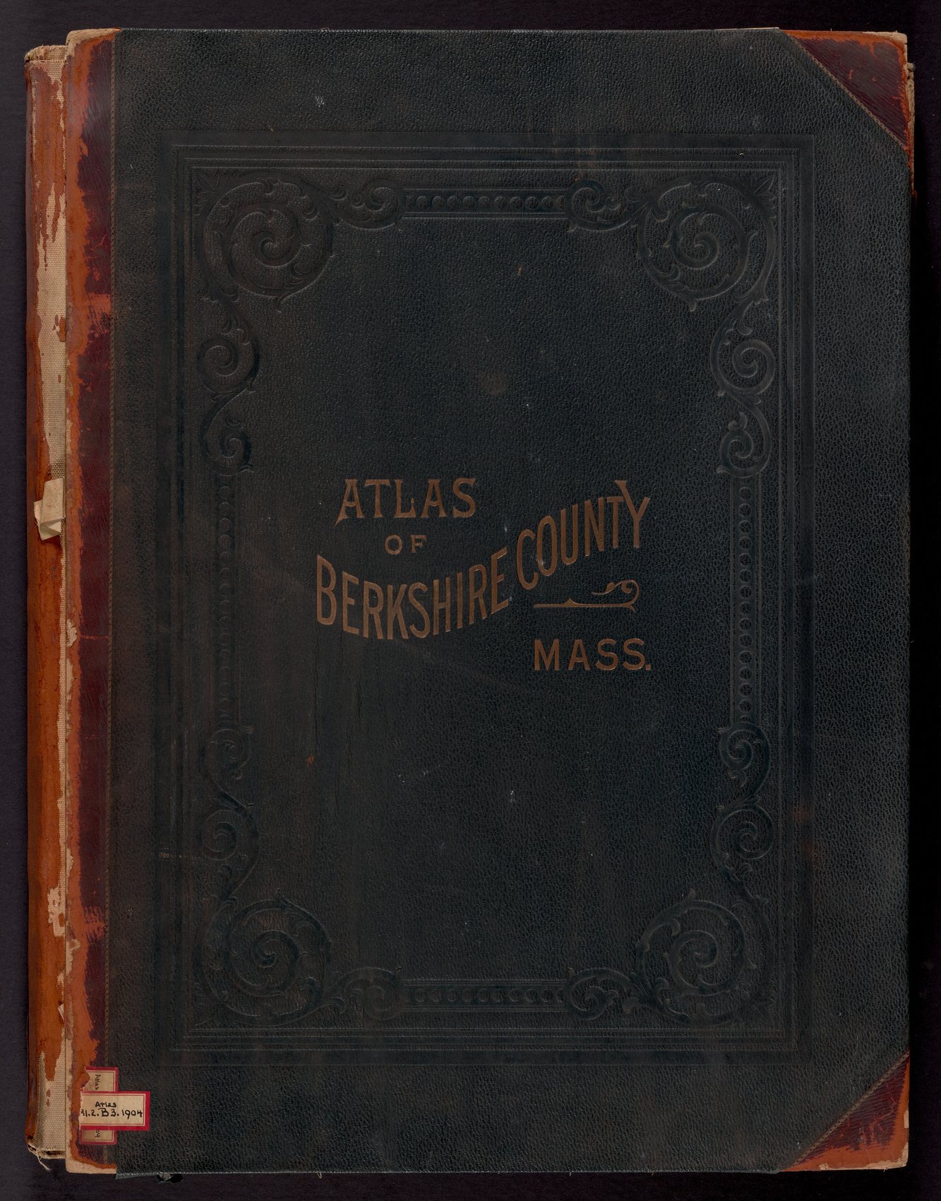
This is a different kind of book from the three directories on this site. A directory tells you a name and a trade. An atlas tells you where the boundary ran, what the building was made of, and who the county surveyor believed owned the ground in the summer he walked it.
I. What it is
Sixty-nine leaves. A title page, a table of contents, a plan of the whole county, fifty-eight numbered plates, and four pages of a Patrons’ Directory at the back. Published by Barnes & Farnham, Civil Engineers, 28 West Street, Pittsfield, copyright 1904, printed by E. P. Noll & Co.
The title page names the men who did the surveying town by town, which is not something the directories ever do:
Assistance rendered by the following Civil Engineers:
E. C. Carter, Lenox · J. W. Curtis, Gt. Barrington · H. P. Linnell, North Adams · D. L. Miller, Adams · J. M. Race, Gt. Barrington
The town plates are drawn at 1,500 feet to the inch; the village and estate plates at 500 feet to the inch, which is close enough to read a stable court.
II. The key is the argument
Every plate carries the same nine-line key in its corner, and it is the reason this book is worth more here than a map of roads would be.
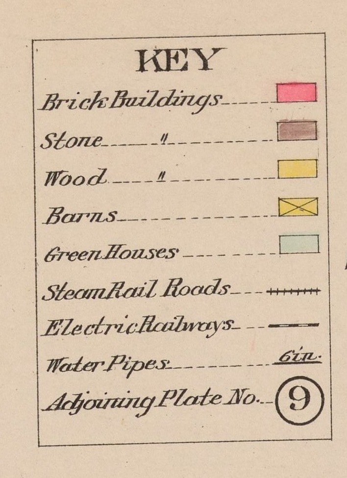
Read that again. Green Houses have their own color. Not gardens, not grounds — the glasshouses themselves, drawn as buildings, range by range, with the individual houses ruled off inside them. Nothing else this site has found maps them.
The rest of the key is just as useful. Brick, Stone and Wood are picked out in three colors, so a plate says what a house was built of before anybody wrote it down. Barns are marked apart from houses, which is how the farm story’s argument — that the farm buildings came first — can be checked estate by estate. Steam Rail Roads and Electric Railways are two different lines, so the Berkshire Street Railway can be traced separately from the New Haven. And Water Pipes are drawn with their bore in inches written along them.
III. What it catches that nothing else does
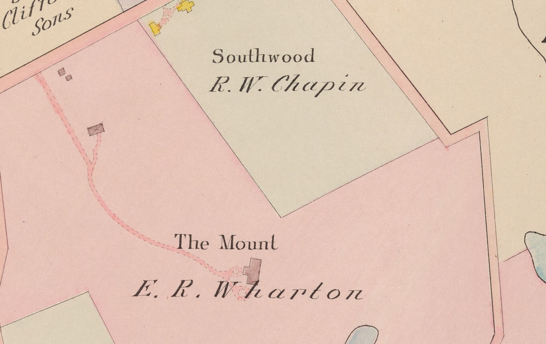
The 1926 directory calls a great house an address. This book calls it a shape. On plate 23 Bellefontaine is a brick cross with a forecourt and a fountain; on plate 22 The Mount is a single gray-pink block with E. R. Wharton under it, in the year she was settling into it.
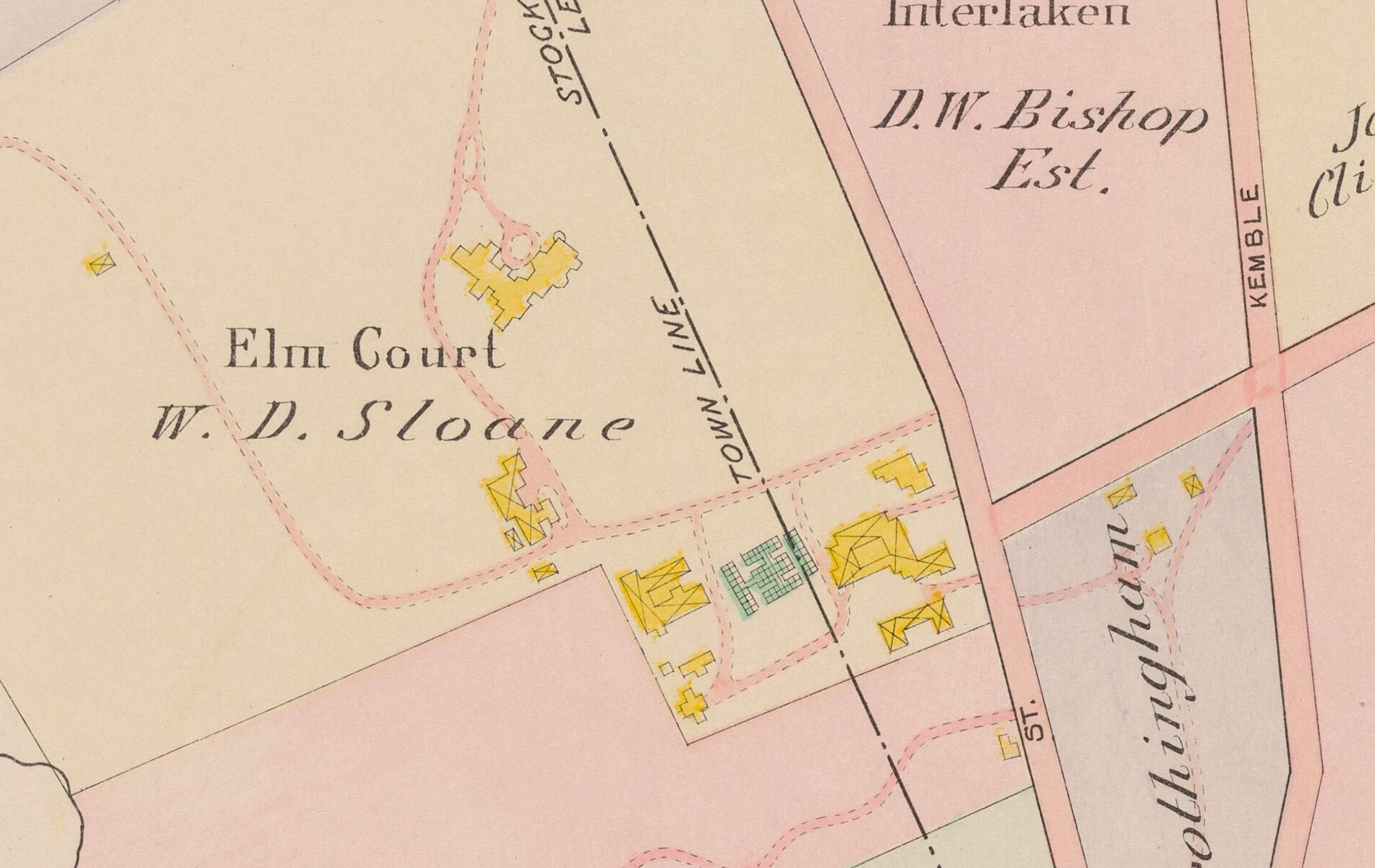
It catches infrastructure the directories only imply. At Erskine Park there is a stone building marked ELECTRIC LIGHT PLANT, sitting on the Lenox and Lee town line — Mrs. George Westinghouse’s own generating station. Above Lenox village the Lenox Water Co. has a reservoir and an Old Reservoir. At Interlaken there is a Pumping Sta. Stockbridge Water Co. At Lenox Station there are Coal Pockets and a Lenox Furnace. The heat, light and water story now has a map.
Reading all fifty-eight sheets rather than the Lenox ones turns the book into a county record. Dalton’s plate 12 letters Crane & Co. on the Government Mill, the Pioneer Mill, the Bay State Mill and a Box Shop at the foot of Crane Pond, with Old Berkshire Mills Co. across the river and Byron Weston’s Centennial and Defiance mills on the next sheet. Washington, a town of a few hundred people, is very nearly one holding: William C. Whitney Estate is lettered across the whole western half of it and repeated parcel after parcel. Hancock’s plate 16 prints SHAKER VILLAGE with Ira Lawson Tr. inside the boundary, which is the Shakers’ land held in a trustee’s name. Great Barrington’s village sheets put E. F. Searles on parcel after parcel along Main and Castle Streets, with “BARRINGTON HOUSE” and SEARLES HIGH SCHOOL; Housatonic is Monument Mills with its MILL No. 1, MILL No. 2, office, freight house, band stand and town lockup. Pittsfield’s plate 2 draws the business district building by building — City Hall, the Athenaeum, the Academy of Music, Bank Row, the Union Depot and its round house — and plate 1 puts the Shaker Village and its round barn at the western edge of the city.
And it catches burial. On plate 21, at the south-west corner of the Wheatleigh land where it comes down to Lake Mahkeenac, the plate prints H. H. Cook — CEMETERY.
IV. How to use it
Three ways in. The plate index takes the book’s own table of contents — thirty-two town plans and about ninety village plans — and turns every entry into a link that opens the right sheet. The names on the plates is every name printed on all fifty-eight sheets, 14,848 of them, read by eye and typed out, so a house can be found by its owner rather than by knowing where to look; it searches the whole county at once and also breaks down town by town. And the Patrons’ Directory at the back of the book is a 1904 subscriber list, arranged by town, in which a great many of the names on the plates appear again with their house names attached.
Inside a plate: drag to move, scroll or pinch to zoom, and the sheet loads in pieces as you go, so a phone never has to swallow a seventy-four-megapixel image whole.
And alongside it: Central Berkshire Illustrated, a book of photographs taken in 1890, fourteen years before these plates were drawn. The atlas says who held the ground. That one says what it looked like.
Barnes & Farnham, Atlas of Berkshire County, Massachusetts (Pittsfield, 1904); published by Barnes & Farnham, printed by E. P. Noll & Co. Reproduced from the Boston Public Library copy through Digital Commonwealth, whose rights statement for it is “No known copyright restrictions” and license “No known restrictions on use”. The State Library of Massachusetts holds a second digitized copy of the same atlas whose scans require prior written permission; it is not used here and no image on this site comes from it. Page images and plate tiles are re-encoded for the web from the Boston Public Library scans at their full size; nothing is retouched, reoriented or cleaned up, and the binding, the foxing and the library stamps are left where they fall. Plate titles are transcribed from the plates, not from the contents page, and the two do not always agree. The town and village lists are transcribed from the book’s own Table of Contents, in its spellings.